Posts

Kangerlussuatsiaq (Evighedsfjord)* - 65° 52' 53" N 53° 48" 37" W

Image
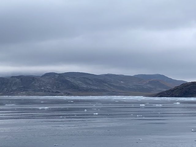
  Wow, just wow - again! This was the view we woke up to.  It is a familiar view but one we usually see when we are hiking, not from an anchorage, on a boat! The weather was spectacular as we made our way further into the fjord.  The fjord is nearly nearly 40nm (75km) long and over 700m deep.  It cuts through 2000m high peaks so it felt a little like sailing along the Bow Valley! Glaciers, glaciers A tide water glacier really is something special How many photos do we need to take?? Like something out of National Geographic - how did I get here?? Not a bad view from the galley when making lunch! Okay, another photo! Hanging glaciers dominated the south side of the fjord and there are several tide water glaciers that drain the Maniitsoq Icesheet. One glacier even feeds two fjords - that's a lot of ice. The mountains off this fjord are deemed some of the best mountaineering and heli-skiing anywhere ... nevermind just Greenland (sorry Revelstoke)! The sky was cloudless and blue and th

Sermilinnguaq - 65° 40' 39" N 52° 33' 02" W

Image
Wow! The photos do not do it justice and I could compose a thesaurus of superlatives when trying to describe this landscape. We continued along the Inner Lead Route north of Maniitsoq, which took us around the island of Kekertarmiut and we did the 5 nm (nautical mile) detour down Sermilinguaq - a fjord with towering mountains on both sides with their hanging glaciers perched in the cirques above us.  At the end of the fjord, the glacier toe was pushing down, almost reaching the water.   Wow, just wow.... These are scenes we are very familiar with, mountains rising from turquoise water, glaciers and waterfalls.  What is so surreal is that we sailed here!  Imagine being on a sailboat in Lake Louise ... but without any ... other ... people.  Outside the communities, we have seen two cruise ships (but they are the  small ones) the odd cabin, some small runabouts and fishing nets pulled up on the rocks. So we have this glorious world all to ourselves.  Oh, and the mozzies!  With the lack of

The Inner Lead Route - Nuuk to Maniitsoq - 65° 25' 01" N 52° 54' 00" W

Image
The Inner Lead Route in West Greenland wiggles through the rocks and islands off the coast.  Our cruising guide says it is intricate, well marked and protected.  BUT there are a number of unmarked rocks and the route cannot be recommended for most cruising yachts.  So, of course, we took it!   We left Nuuk in thick, windless fog.  This tested our metal with the idea of negotiating rocks, narrow passages and icebergs using untested charts. Much to our relief, the fog lifted just as we were approaching the entrance and in we plunged!  Dead calm and low visibility Very foggy leaving Nuuk - nothing to see here! We weaved through channels between islands, past rocky outcrops and isolated rocks.  The charts proved to be very accurate and rocks appeared just when they should!  We encountered a couple of icebergs.  As it was calm and the water was very clear, we ventured over to take a closer look. They were quite small and we could easily see their extent underwater so not at risk of a Titani

Nuup Kangerlua - 64° 21' 03"N 51° 23' 39" W

Image
Nuup Kangerlua* is a 160km long fjord behind Nuuk. We have been watching the icebergs float past our anchorage and learned that they originated from the top of the fjord where two glaciers drain the Greenland Icesheet.  Icebergs! We'd better take a look! *According to the West Greenland Pilot, kangerlua means fjord in Greenlandic We headed up the fjord with the plan to circumnavigate Sermitsiaq Island, anchoring for the night at the top end.  We were not disappointed when it came to icebergs.  There were dozens!  And all relatively small so it felt safe to get up close and have a look.  They came in all sorts of amazing shapes but what stood out were the colours - just the most remarkable shades of blue. Amazing colours and the water was very clear so we could see how big it was underneath.   Bergs and bergy bits everywhere! We went ashore and did some target practice with the newly purchased rifle.  No, we haven't suddenly become gun-totting North Americans, it really IS for o

Nuuk - 64°11'31" N 51°43'26" W

Image
Nuuk is not a common tourist destination … yet. After a long, long passage, we motored into the harbour with intentions to find something solid to tie on to. We called the harbourmaster on Channel 16 and asked for docking instructions. We were told that there was nowhere that we could tie up, and anyway there were very few berths (in general) for boats of our size. We could anchor in the harbour, but that really wasn’t advisable. So, we quickly consulted the cruising guide for the area and read about an alternate anchorage on the north side of the town. It was twenty minutes away. Off we went. The little cove was perfect, so we dropped anchor, secured the boat and then fell into our bunks. After a day of rest and tidying up the boat, we went into town to check into Greenland (immigration) and then to be tourists. We dinghy-ed into a small, rocky beach and hauled the dinghy up past the high water mark. We ditched our rubber boots for hiking boots and then picked our w