Long weekends in the mountains are for working folk.
We have learned that Canmore locals try not to use the trails, rivers, pathways or any alpine niceties when the hordes from the flatlands are released from their jobs on Friday. What used to be a trickle of outdoorsy people that came from Calgary has become, mid-COVID, a flood of locked-down freedom-seekers.
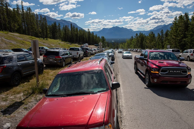 |
Highway 742, a normally quiet road that happens to have a trailhead close by
|
If we have friends that suggest a weekend hike, we sigh deeply, then try to pick one of the non-popular trails ... and one that isn't just a slog through the woods. I, personally, prefer a panorama to a idyllic lake nestled in a valley. Also, instead of just summiting a single peak and having to turn around, I LOVE a chance to walk along a ridge, from peak to peak, coming down a different way so I don't have to see the same trail I just slogged up, in reverse.
As Kate has been doing quite a bit of trail running this year, she has inspired Gord to do a big run (a 50 kilometre trail run) prior to his 50th birthday in October. In order to train for this big event (the trail run - NOT the birthday) they have been hitting the single track in training. I will tag along, more often on my mountain bike but sometimes on foot.
Gord suggested we do a run this weekend and was happy for Kate to pick a good route. Well, she absolutely hit it out of the park with her suggestion for today's outing.
Tent Ridge is not only a ridge walk, but a loop that means we are not backtracking at all. The route was 11 kilometres of distance and 893 metres of vertical (usually a better indication of how hard the route will be than the distance).
We started early and met Gordon at the trailhead. We decided to travel light, wearing trail running shoes (instead of hiking boots), lightweight running gear and minimal packs with only the essentials. The weather cooperated, the flowers cooperated, the teeming masses cooperated (by staying away and leaving us with an almost empty trail) and luck cooperated by allowing us down the mountain with no injuries.
 |
Our route - click on the map above for the stats
|
 |
300 metres up and 3 kms from the car, we reach the first alpine meadow.
In an hour, we will be on that ridge in the background.
|
 |
| About to leave the treeline and proceed up to the first peak |
 |
Scrambling up rocks but loving it
|
 |
A marmot watched us, unconcerned, as we passed
|
 |
Almost at the first peak.
|
 |
| Delicate alpine flowers, with the ridge we are about to walk along in the background |
 |
Kate looking over the Smith Dorrien Spray Valley
|
 |
| Looking across to the traverse from the first peak to the ridge walk |
 |
Heading down some light scree (loose pebbles)
|
 |
| Picking our way along the ridge |
 |
Gord and Kate along the far ridge
|
 |
Fluffy cumulus clouds and a bit of wind kept us cool
|
 |
Headed towards the last peak
|
 |
Following an old creek down from the ridge into the trees
Can you spot the Blue-shirted Redhead?
|
 |
| The flowers were all out, including Indian Paintbrush |
What a day!


Comments
Post a Comment