Posts

Showing posts with the label Canadian Rockies

Canmore Highland Games - 51° 05' 13" N 115° 21' 27" W

Image
As Community Cruisers was to provide bike parking at the Highland Games, in my new role of Volunteer Coordinator, I gave the President a call to see what they required.  The President, Sandy Bunch, has a rather strong Glaswegian accent.  As I came off the phone, I had a disturbing feeling I had committed to something a little more than bike parking! A few days later, a follow-up phone call from Sandy confirmed that I had indeed agreed to becoming the Volunteer Coordinator for the whole Highland Games!  Good grief! Somebody, PLEASE, remind me to never again grunt assent when I don't understand a word! My first committee meeting was filled with talk of kaylees, heavy sports and whiskey tastings.  The only part I was sure of was the whiskey tasting.  That, I could get into!  Consulting The Google, I discovered that heavy sports was the competition one finds at Highland Games. It includes athletic events such as the tug o'war, caber toss, hammer throw, stone pu...

Nakiska Ridgetop Weather Station – 50° 56’ 37” N 115° 11’ 23” W

Image
Being tethered in place is much worse for some than others. As COVID restrictions have flattened our appetite for straying too far from home, we have dedicated this summer to exploring the less-known trails close to us. We are doing mostly day-trips. Names that we have heard mentioned – Sarrail Ridge, Windy Tower, Old Goat Creek – have been added to a list of Hikes We’ve Been Meaning To Get To. We decided that adding to our quiver of “known hikes” will make it easier to show our future guests a good time. When it is overcast (or smoky), you can still hike – you just stay in the valleys and trees. If you are hiking with friends that aren’t used to the altitude (or who aren’t as fit), there are less strenuous hikes. Some hikes feature waterfalls. Some hikes are more technical (meaning there could be some light climbing/scrambling). Some hikes have criss-cross back and forth over streams, with quaint bridges. Some hikes have panoramic views … but require going up 1,000+ metre...

50km for a Milestone Birthday - 50° 52' 08" N 115° 21' 08" W

Image
This is Gordon.  Gordon is turning 50.  Gordon thinks doing a 50km run is a fine way to commemorate this milestone. This is a bottle of wine.  It is while drinking this bottle of wine that Gordon managed to convince Kate to join him of his 50km/50th birthday run. Oh dear! This is the course they decided to run.  From Buller Mountain, along the High Rockies Trail to Goat Creek then along the Goat Creek Trail to Bow Falls in Banff.  If you have your choice of routes, one with plenty of down is a wise decision. Even so, 50km is a bloody long way to run! This is at the starting point at Buller Mountain.  They are smiling, looking keen and eager.  Gordon still seems to think this is a good idea! This is at Three Sisters Dam, almost at the halfway point.  Still standing, still smiling - this is a very good sign.  Or perhaps it is just the fresh shoes and socks that is causing the smiles? This is at Bow Falls - the 50km mark....

Tent Ridge Trailhead - 50° 50' 50" N 115° 21' 28" W

Image
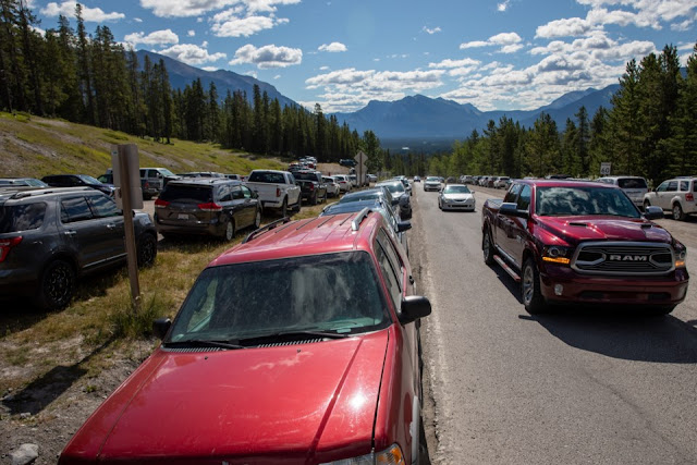
Long weekends in the mountains are for working folk.   We have learned that Canmore locals try not to use the trails, rivers, pathways or any alpine niceties when the hordes from the flatlands are released from their jobs on Friday.  What used to be a trickle of outdoorsy people that came from Calgary has become, mid-COVID, a flood of locked-down freedom-seekers.   Highway 742, a normally quiet road that happens to have a trailhead close by If we have friends that suggest a weekend hike, we sigh deeply, then try to pick one of the non-popular trails ... and one that isn't just a slog through the woods.  I, personally, prefer a panorama to a idyllic lake nestled in a valley.  Also, instead of just summiting a single peak and having to turn around, I LOVE a chance to walk along a ridge, from peak to peak, coming down a different way so I don't have to see the same trail I just slogged up, in reverse. As Kate has been doing quite a bit of trail running t...

Banff Park Gate - 51° 08' 05" N 115° 24' 23" W

Image
The longer I live in my newly adopted mountain village, the more interesting bits of its history I learn. Yesterday I did a mountain bike cruise along the Powerline Trail and travelled through the unfinished Three Sisters Golf Course.  It is a project that started in the 1980's and has been owned by several companies - many of whom have gone bankrupt.  As I rode through the wide open spaces that had been cleared of trees, I passed stands of deer and elk grazing on the exposed grassland.  A stream wound its way down the hillside and into a beautiful manmade reservoir before continuing down to the Bow River. It prompted me to do some research when I returned home.  I found a video about the area that was curated by Jerry Stephenson, a long-time local that was the chief engineer at the Canmore Mines until their permanent closing in 1979. Click here to watch the Video! It warns of the danger of developing the land there any further than light recreational (...

Elizabeth Parker Alpine Hut - 51°21'26" N 116°20'21" W

Image
There are many beautiful places in the world.  This is one of them. As part of our year of staying (sort of) in Canada, we are venturing into a few of the places close-by that we have been meaning to get to for forever.  Many, many times we have driven by the turnoff on Highway 1 that leads to Lake O'Hara.  The parking lot twelve kilometres past Lake Louise is as far as anyone can get in a private vehicle.  This being winter, we donned cross-country skis as well as backpacks for the eleven kilometre trek into the lake. The out-and-back route - click for a bigger view. Starting with some uphill ... ... and more ... We only decided to make the trip in a month prior.  Some friends from the running group (Pamela, Grace and Jim), joined us on a Tuesday morning at the trailhead at 11 am.  The fire road is undulating uphill with a solitary picnic bench just past the 5 km marker.  The trail twists and turns through the valley south of M...