The Inner Lead Route - Nuuk to Maniitsoq - 65° 25' 01" N 52° 54' 00" W
The Inner Lead Route in West Greenland wiggles through the rocks and islands off the coast. Our cruising guide says it is intricate, well marked and protected. BUT there are a number of unmarked rocks and the route cannot be recommended for most cruising yachts. So, of course, we took it!
We left Nuuk in thick, windless fog. This tested our metal with the idea of negotiating rocks, narrow passages and icebergs using untested charts. Much to our relief, the fog lifted just as we were approaching the entrance and in we plunged!
 |
| Dead calm and low visibility |
 |
| Very foggy leaving Nuuk - nothing to see here! |
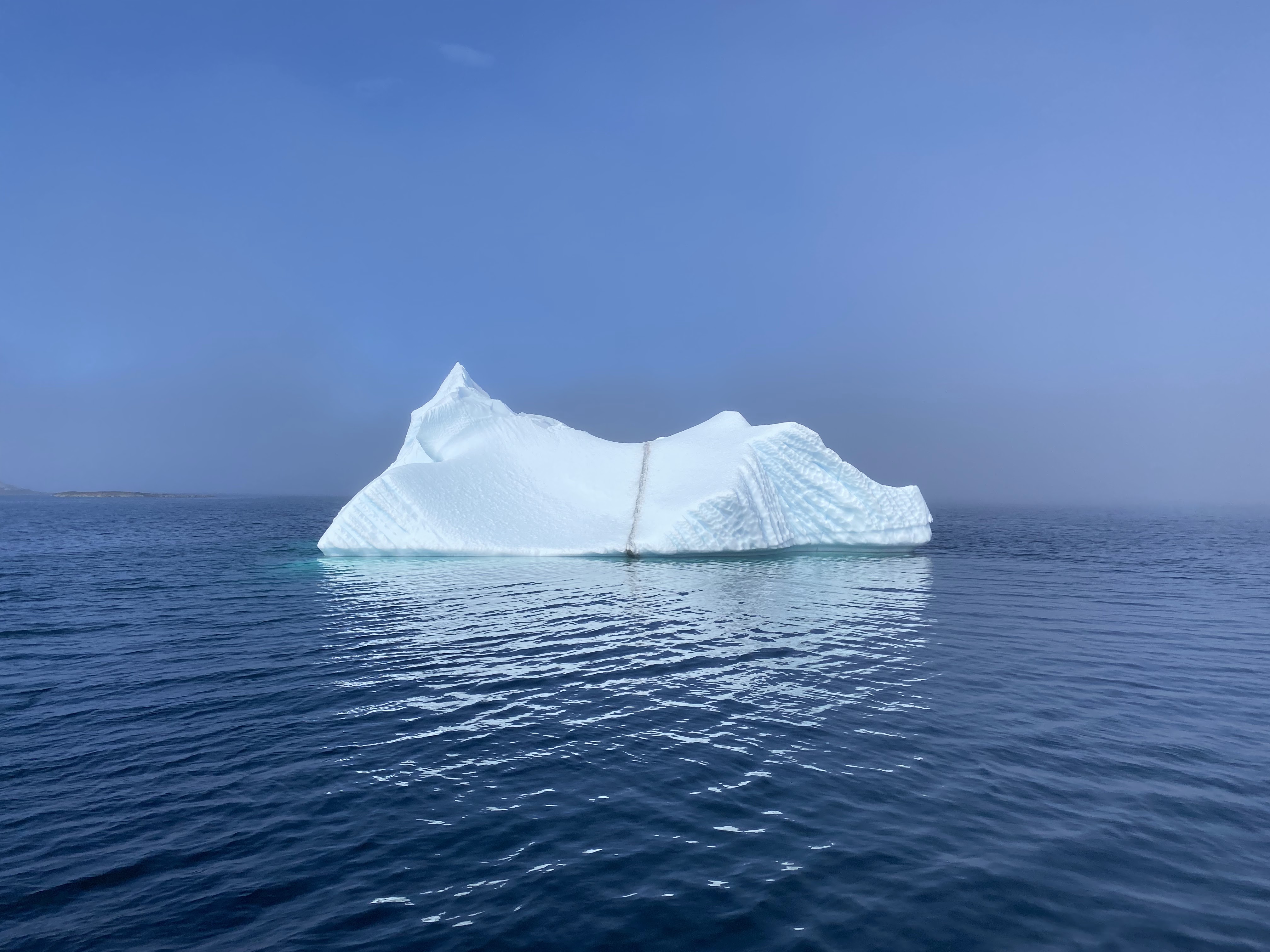
We weaved through channels between islands, past rocky outcrops and isolated rocks. The charts proved to be very accurate and rocks appeared just when they should! We encountered a couple of icebergs. As it was calm and the water was very clear, we ventured over to take a closer look. They were quite small and we could easily see their extent underwater so not at risk of a Titanic moment.
 |
| Up close and personal with an iceberg |
 |
| Hello iceberg! |
The route is marked by a series of markers, the squares marking port and the triangle marking starboard (if you are travelling north). It was straightforward marking our route on the chart but we did do a lot of searching for the markers which could be anchored on small rocks, high on large islands or hidden by the rock in front.
 |
| Port route marker |
 |
| We literally 'sailed' out of the fog |
More wiggling and winding landed us in Maniitsoq, a village of 2,500 souls. Wonderfully quaint with the colourful houses and soaring mountains - and the best thing, room alongside the dock for us to berth. We enjoyed our first dinner in the cockpit with the warm, night sun beaming down.
 |
| Maniitsoq |
 |
| The bridge looks like a recent addition to the village but while walking around, we saw a picture of the same bridge from 1971 |
Greenland is such a surprise. We did not expect the towering mountain range or the turquoise water. The Inner Lead Route is such a treat allowing us to be part of the scenery rather than seeing it all from a few miles out at sea. This is despite sage advice from the West Greenland Pilot - 'should be navigated with caution. This route is the most difficult and most rock-filled of all the inshore routes in Greenland, and should only be used by smaller vessels with navigators having local knowledge'!! Whoops! We read this little gem after we had safely transited the section. With electronic navigation and a shallow draft boat, we did not feel we were taking any unnecessary risk.
 |
| The Inner Route winds between rocks and islands in protected waters. |
And check out Marisa and Adriano's video @our_tern on Instagram:
Chapter 83 - Unchartered Territory
Wow, great highly visible marks! I did race committee on the bay this past weekend and we spent way too long looking for a mark that we decided was missing; then had to scramble setting up an alternate course. Biggest challenge was figuring out and getting appropriate signal flags up on the RC boat.
ReplyDeleteMaybe the bridge leads to a Starbucks?! ... Greg
ReplyDeleteOhh, a flat white...
DeleteWhat an adventure! So glad your navigating skills & technology are working well for you. 💕 Love your sharing and photos.
ReplyDelete