Outer Hebrides - 58° 12' 34" N 06° 23' 23" W
 |
| Ashore |
We woke up inside the ring of islands and were pleased to have blue skies for our day of exploration on the biggest of the Shiant Islands. There were no permanent inhabitants, but plenty of sheep and birds. Living on a ship takes its toll on your cardio fitness and we were going to make ourselves wheeze a bit by climbing to the top of the cliff.
We came ashore on the gravelly isthmus between the two nodes of Garbh Eilean (eilean means 'island' in Gaelic) and walked over the rise to see the bothy we spotted when we were approaching the island group yesterday.
 |
| Bothy facing south |
Most countries that have vast extents of wild areas to walk/hike in have some form of shelter that have been left for use of travellers. This one would have originally been a shelter for the shepherds when the sheep were brought here for the summer.
 |
| The bothy |
 |
| A view to the south |
 |
| A view to the west |
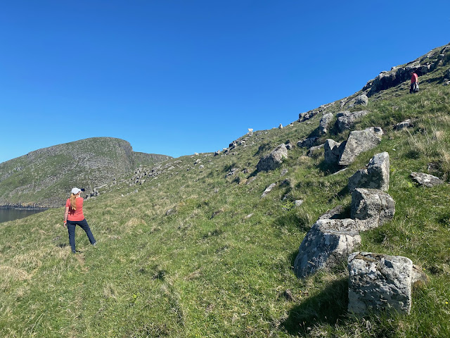 |
| Hmmmm ... lamb for dinner tonight? |
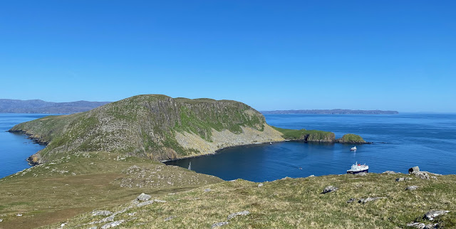 |
| The Shiants attracts not just sailboats like us, but also the smaller cruise ships like this one ... albeit for the well-heeled seafarers. |
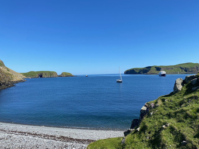 |
| There seems to be a hole on the far end of the island. Shall we have a look? |
With very little wind, we set out across The Minch, bound for Stornoway and discovered our bow thruster was not working! Yikes. Not a big issue when sailing but makes manoeuvring in harbours a little tricky. And the marina in Stornoway is narrow and shallow! Fortunately, the Harbour Master assigned us a hammerhead berth so we could just run in without much manoeuvring.
 |
| Goose Wing welcoming us into Stornoway Harbour |
And we arrived in Stornoway Harbour to a welcoming committee! Toby and Sally aboard their lovely yacht, Goose Wing. We met them snow-hosting a few seasons back and it was a great welcome we received in The Outer Hebrides (or the Western Isles as they are also known). We had a fabulous evening on board Chinook with Chinese take-way for dinner. Yummo!
 |
| Lewis Castle |
 |
| Depictions of the Lewis Chessmen, rare 12th-century whale ivory chess pieces discovered on Lewis |
 |
| View from the Castle back to the marina. Not bad digs! |
The weather was glorious, we are starting to expect nothing less from Scotland! After a wander around the castle, Toby and Sally picked us up for a tour of the island - both Lewis and Harris. They are actually one island with a narrow isthmus joining them and are named as if they were two. Touring with locals means you learn a lot!
We learned that three-quarters of residents in the Western Isles (Outer Hebrides) live on community-owned land, similar to the set up on Eigg. Community land, owned and managed collectively. As crofts as leased and cannot be mortgaged, many houses have been 'de-crofted' so you are able to get a mortgage on it and own your home but the remaining land is owned by the community. Each croft comes with grazing rights on common land and peat cutting rights. Crofting is supported because the style of farming manages the land well.
Sally and Toby explained the peat cutting process to us. Using a tairsgeir (pronounced tarashaiga), the turf and topsoil are removed from the peat bank and laid on top of the previous year's cut. The peat is cut in three vertical layers in blocks roughly the size of an A4 page and about 5cm thick. One person does the cutting and one takes the peat blocks and lays them out - first cut goes on top of the peat bank, the second behind on last years cut and the third behind the first on the peat bank. This continues all the way along the bank.
 |
| A cut peat bank |
The blocks are left to dry, how long depends on the weather. They are then turned and piled up into little pyramids so the other side can dry and the rain will run off them. Once the peat has dried, which can take a couple of months, it is collected and stacked in a special way to ensure the water runs off the stack and the majority of the peat stays dry. Toby was a bit sad their peat was yet to dry so he couldn't use our labour to help bring it in!
 |
| Peat drying on the moors. The best peat banks are those close to the road, as it makes collecting it easy! |
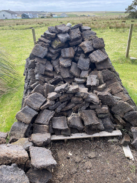 |
| Sally and Toby's peat stack |
Moors are desolate, wild and windy. Wide expanses of peaty bog that are difficult to traverse, even in this very dry year. No wonder Bonny Prince Charlie had such troubles after he fled to Lewis following his loss at Culloden.
 |
| The moorlands go on and on and on, spongy and wet |
Harris was even more barren, rugged and rocky than Lewis with lakes perched between between the rocks and hardy sheep munching on patches of green. We drove The Golden Road, a 'must do' on Harris according to Trip Adviser, tucked between distillery visits and beaches! It was named the Golden Road as much for the huge cost it took to build as for the great access it gave the locals to the bigger centres and each other. It would have been a footpath walk of several hours prior to this. We enjoyed having a beautiful day for the drive and the scenery was magnificent. It would be a desperately difficult place to eke out a living by farming.
 |
| Very similar to the terrain (and place names) of Newfoundland |
.jpeg) |
| Greosarhagh - a town along the Golden Road |
 |
| Barren and rocky - a tough place to farm |
 |
| Why are the United Nations of flags a-flutter in Tarbert? Just ask a local! |
We were puzzled to see the Ukrainian, Greenlandic, Canadian and Mexican flags fluttering alongside the Scottish flag. Thanks to our local connections, we learned why. Donald Trump's mother was from Tong on the Isle of Lewis, just north of Stornoway. Those here believe she would have been dreadfully ashamed of him and his actions since becoming president. A traditional mother's reprimand to her children is to use their full names - so 'Shame on you Donald John' is how the Hebrideans are expressing their displeasure with him.
 |
| "Elbows Up' - Lewis style |
We drove back along the west coast of Harris and the beautiful sandy beaches it is famous for. Google the Isle of Harris and Seilebost Beach is guaranteed to show up.
 |
| Seilebost Beach, absolutely stunning on this sunny day |
A wonderful, quaint little quirk of the Outer Hebrides is that nothing is done of a Sunday. It was religious and now simply cultural. Buses don't run, the shops are not open, even hanging out washing and lawn mowing is left for another day. These days, people go on walks, bike rides, gather with family. It is such a lovely break. You would generally not visit unless invited. In recent months the local Tesco is now open for a few hours on Sunday afternoons, which caused a bit of controversy.
In the absence of anything being open, Toby and Sally picked us up and took us back to their house for lunch. They toured us around their croft and showed off their Polycrub. The Polycrub is an amazing story. It was originally designed in Shetland as part of a community development project to reduce food miles and grow more fresh produce locally. The issue was the wild Shetland winds that simply blew away the more traditional poly tunnels.
 |
| Toby and Sally's Polycrub |
Using waste pipe from the aquaculture industry and a very sturdy polycarbonate, they designed a greenhouse strong enough to withstand the Shetland gales. They are now sold all over the UK and Ireland. The name comes from the traditional circular stone shelters the Shetlanders used to build to protect their young plants, mainly cabbages, from the wild weather. These were called planticrubs so they combined the new materials with the old name to create Polycrub. We have been really impressed by the range and number of social enterprises around Scotland, particularly on the smaller, more remote islands.
We then had Sally and Toby drive us to the very tippity-top of Lewis - the Butt of Lewis. We braved the wild winds and the rain to amble along the clifftops with the waves crashing below. Very pleased to be seeing it from land and not from Chinook.
 |
| The Butt of Lewis |
The next day, we decided to ride across the island to the Calanais Standing Stones. It was a great ride - sunny with a healthy cross-tail wind. We saw miles and miles of peat bog.
 |
| T-shirt weather ... finally! |
The road was mostly paved with sections of gravel. Our Bromptons proved themselves to be great gravel bikes. We saw a few cars, but not many.
Once we reached the Standing Stones, we surprised how accessible they were. There was a car park in middle of field and a simple sheep fence to keep the critters out, but otherwise available to walk around, look, touch and marvel. Via carbon-dating material found close by, researchers know they are older than Stonehenge, not sure why they were built. On this island there are eleven stone circles in all - three major ones.
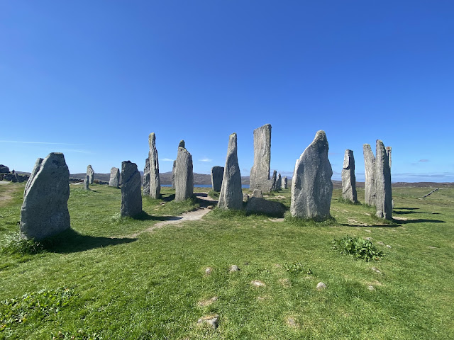 |
| The pathway goes right through this set of standing stones. Walk right up and have a look. |
 |
| Full access. You can walk right up and give 'em a hug! |
We had planned to ride back to Kirkwall but were thwarted by a flat tyre. (perhaps not such great gravel bikes after all!) It was very convenient that a community bus runs by here every sixty minutes and that our bikes fold up into a carry-on size.
That evening, we were invited to join Toby and Sally for a ceilidh in their community hall at Ness. So, back to the bus stop and we went and climbed aboard the bus to Toby and Sally's house. The island is so small and everyone knows everyone, so giving the name of the family you are visiting to the bus driver will ensure he lets you off at the right place along the road.
The ceilidh at the Clan Maquarrie Community Hall was so much fun. There were about 100 people at the event, which featured some young accordion players (encouraging the new generation) and the old-timers.
 |
| The new Maquarrie Hall, with the original in the background |
The hall was named after a ship that was wrecked near Bovre in 1953. All crew were saved and housed by the locals. As a thanks, the company who owned the ship gave the community money to build the first community hall. This wasn't the original hall - it was the new and improved one (built in 2010) and is named for the ship.
.jpeg) |
| Kate dances a reel with Toby. It looks like we were the only ones there, but other photos with more people weren't of the best quality. |
We are recuperating now, but plan to leave tomorrow to sail north towards the Shetland Islands.
And please remember that Blogger posts your comment as anonymous if you don't have an account, so please sign off with your name so we know who you are!
An amazing part of the world. We enjoyed similar weather when we were there: Paul C
ReplyDelete