Tombstone Campground, Yukon - 64°30'23" N 138°13'21" W
Despite having visited and travelled through many, many places around the world, I was always a bit embarrassed to admit that I hadn't been very far north in my own country. I had been to Fort McMurray but not further into the top half of my homeland. Even Kate, my Australian-born bride, had been closer to Santa's Workshop than I have. We knew there was a rough road that meandered all the way to the Arctic Ocean, but it took some investigation to learn that it was called the Dempster Highway.
Pre-COVID we planned a trip. Chatting with the Australian family, Wendy and Graeme showed interest in joining us. Late August/early September was set as the timeframe to:
Spoiler Alert: In the end, we succeeded fabulously on all points.
Although COVID delayed our trip (originally planned for September 2020), rescheduling for 2023 meant that more people wanted in on the fun. We ended up with both of Kate's sisters and their husbands and two other Aussie sets of friend-couples.
We flew into Whitehorse and the group gathered from the far-flung places they needed to come from. We had unusually warm weather that allowed the Antipodeans to adjust to being north of 60 degrees.
Two days was enough to get all the couples together and over the grogginess of travelling, wander the main commercial districts of Whitehorse and to pick up our rental truck/campers and Kate and Sean's motor home.
Pre-COVID we planned a trip. Chatting with the Australian family, Wendy and Graeme showed interest in joining us. Late August/early September was set as the timeframe to:
- avoid the swarms of bugs that summer brought
- be there for the fishing season (more to enjoy the bounty than do the fishing)
- catch part of berry season
- possibly get lucky with the turning colour of leaves
Spoiler Alert: In the end, we succeeded fabulously on all points.
Although COVID delayed our trip (originally planned for September 2020), rescheduling for 2023 meant that more people wanted in on the fun. We ended up with both of Kate's sisters and their husbands and two other Aussie sets of friend-couples.
 |
| Simon, Susan, Kate and Sean were the last to arrive in Whitehorse. The river trail is great! |
We flew into Whitehorse and the group gathered from the far-flung places they needed to come from. We had unusually warm weather that allowed the Antipodeans to adjust to being north of 60 degrees.
 |
| There's some great public artwork in and around the parks of Whitehorse. |
 |
| The Main Street is much more vibrant than I was expecting. It helped that the weather was unseasonably warm. |
 |
| A cool statue honouring the humble prospectors that were (mostly) the reason for Whitehorse's boom times. |
 |
| ... and a bust of one of Sean's favourite old-timey poets - Robert Service. |
 |
| One of the many great shops along Main Street. |
 |
| Whitehorse is located on the Yukon River and prior to road, rail and airplane, it was best reached by this shallow waterway. They have a partially-restored paddlewheeler, the S.S. Klondike, at a National Historic Site on the river pathway. |
 |
| It was nice to see some recognition of the First Nations people who have lived here for thousands of years before the Europeans arrived. |
Two days was enough to get all the couples together and over the grogginess of travelling, wander the main commercial districts of Whitehorse and to pick up our rental truck/campers and Kate and Sean's motor home.
 |
| Just SOME of the stuff we brought. This is before we started provisioning. |
 |
| Loaded and ready to go - the Australian/Canadian convoy! |
 |
| An easy drive but we still did it over two days to get accustomed to the vehicles and to check out all the viewpoints and roadside pullouts along the way. |
 |
| The Yukon River and the big, wide valley it travels along. |
 |
| We stopped at a trailhead to a viewpoint over the Five Finger Rapids on the Yukon River. |
 |
| Five Finger Rapids. |
 |
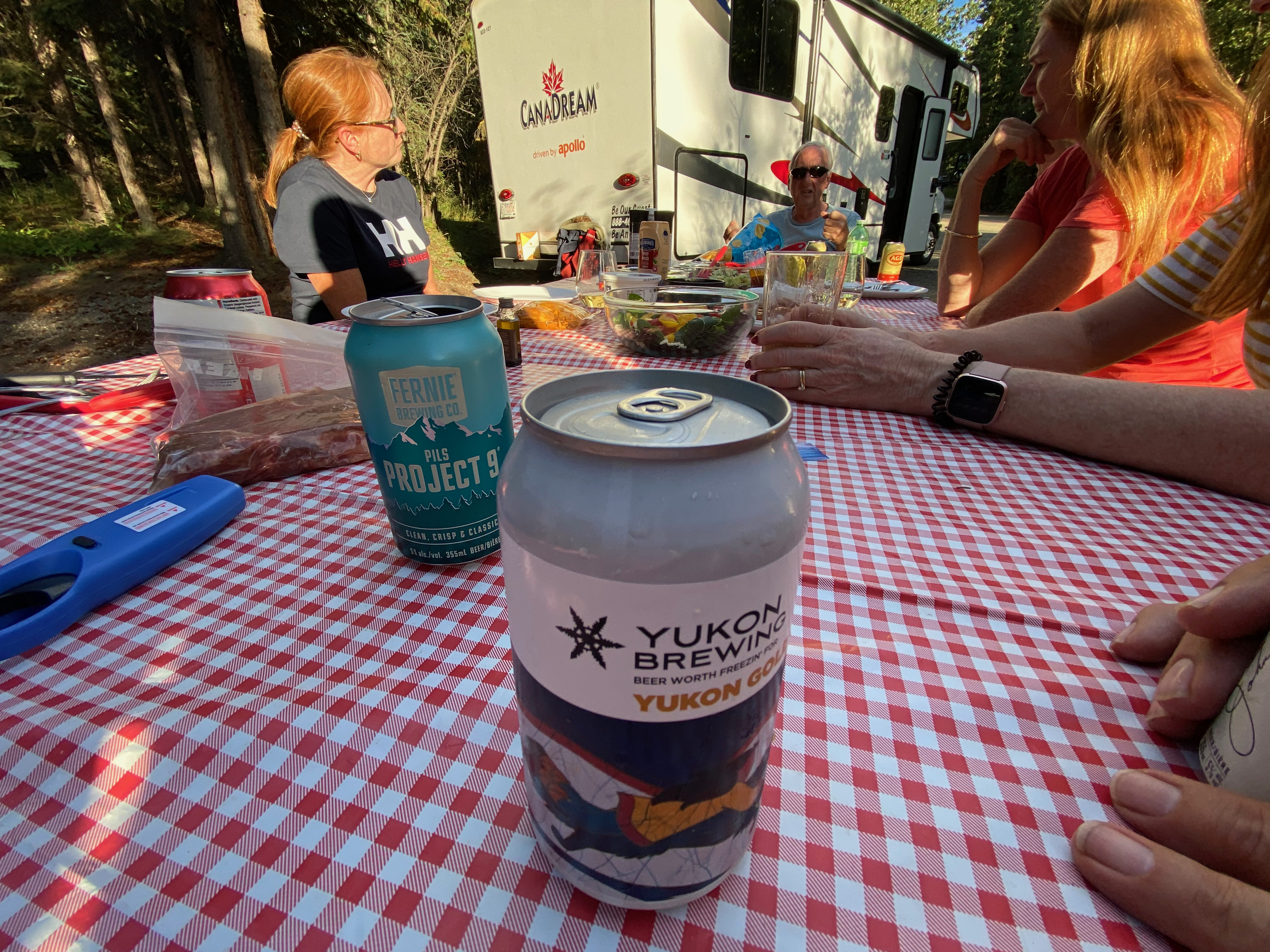
| The warm weather allowed us to pull out camp chairs and enjoy our first night's stop at Fox Lake. There was even short and ceremonial dunks and plunges into the lake. North of 60 degrees (latitude and Fahrenheit)! |
 |
| Just like being in the tropics, Kate? |
 |
| The Yukon has beautifully maintained campsites. |
.jpeg) |
| Awesome, awesome sunsets. |
 |
| ... and firepits. |
 |
| The second day of travel on paved roads leads us towards the turnoff at Pelly Crossing and closer to the start of the Dempster. |
 |
| Here's where the intrepid part begins! |
 |
| The first sign (literally) of the Arctic Ocean. |
 |
| Approaching the Tombstone Range along the Dempster. |
 |
| It is becoming much more mountain-y. |
 |
| Less treed and more rugged. |
 |
| More sparsely treed made for great, sweeping sightlines as we drove along. |
 |
| Our first camp on the Dempster was at Tombstone Park. We made this a base as they had an excellent interpretive centre, some easily accessible hikes and a nice campground. |
 |
| The Interpretive Centre. Very modern, solar backup, staff accommodation, great displays. |
 |
| Dog friendly, too. |
 |
| Some hikes were easy boardwalks, but still offered as guided walks by the Parks staff. |
 |
| I was surprised at how treed the area was. This far north, I was expecting the flora to be small scrub and bushes. |
 |
| Other hikes were longer and more trail-like. We did this one with one of the Parks staff and hiked up to a lookout spot. |
 |
| On the trail with Brianna, the Parks guide. |
 |
| The viewpoint even had a good spot for pictures. |
 |
| We did the Grizzly Lake trail as a group, but just 7 kilometres to the ridge viewpoint and back. |
.jpeg) |
| As all good hikes do, this one started with lots of up. |
 |
| We meandered through some marshy areas. Pine, bunchberries, alder and we JUST missed the raspberry season. |
 |
| The bear berries added bright colours to the trail. |
 |
| Looks like a few of the party are more interested in summiting than taking pictures. |
.jpeg) |
| Susan and Simon look down the valley on our way to the ridge. |
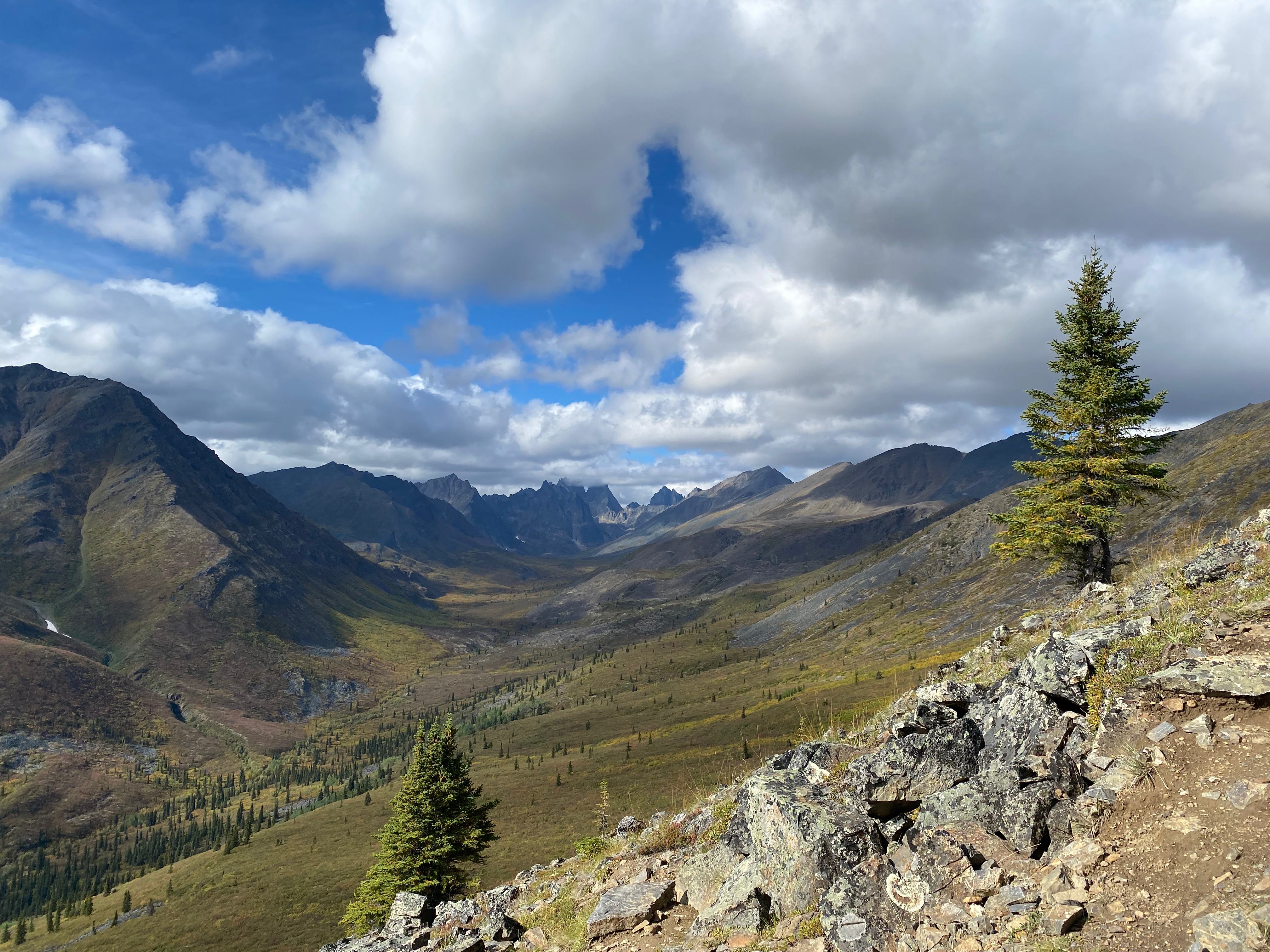 |
| What a view. |
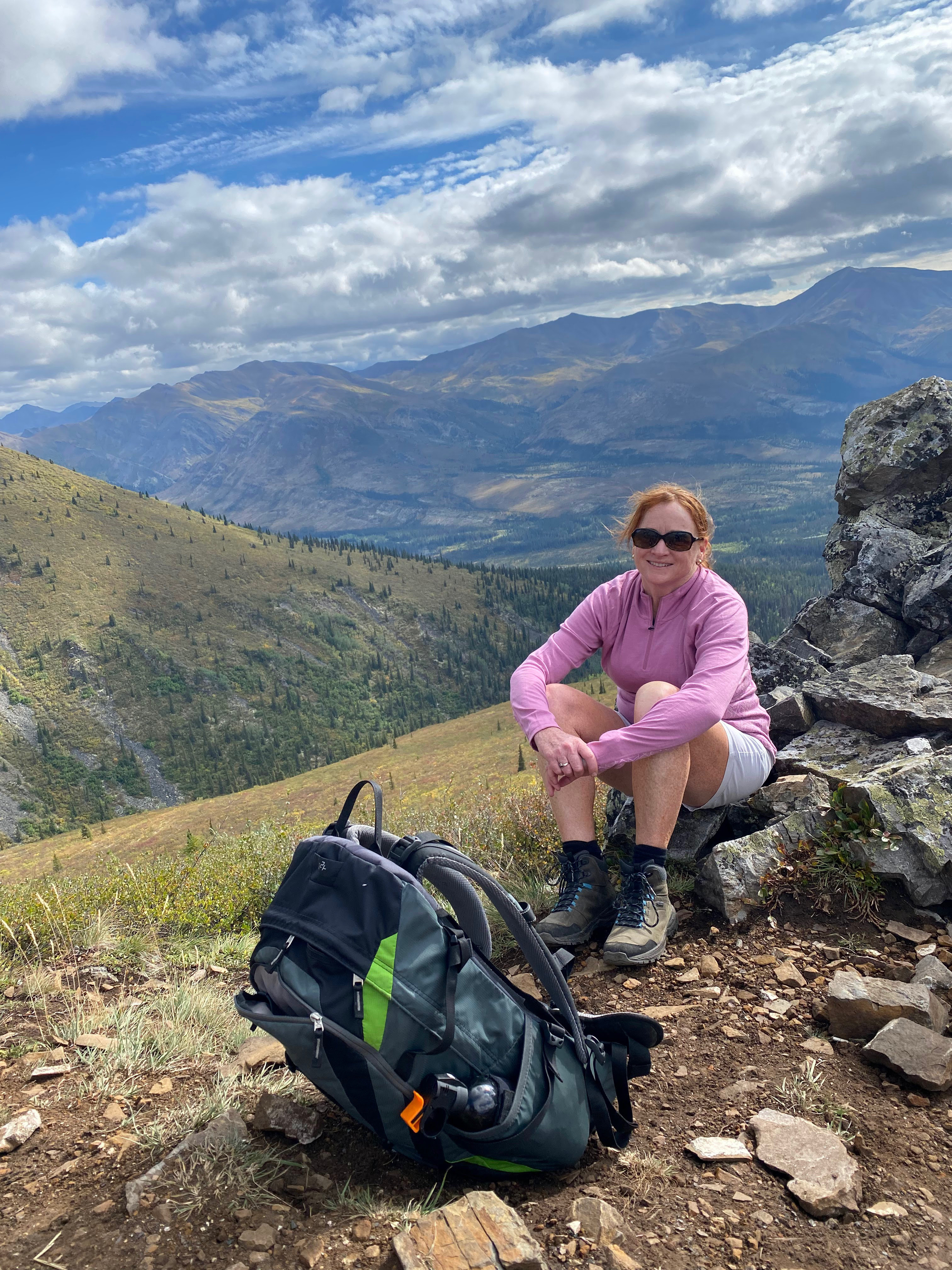 |
| Susan at the ridge lookout. |
 |
| After three days of hiking and evenings of comfy, t-shirt temperatures, it was time to continue north. |
 |
| Up to this point, the gravel roads didn't seem that big a challenge. This was about to change. |
Comments
Post a Comment