This is a chinook - 51° 05' 03" N 115° 22' 07" W
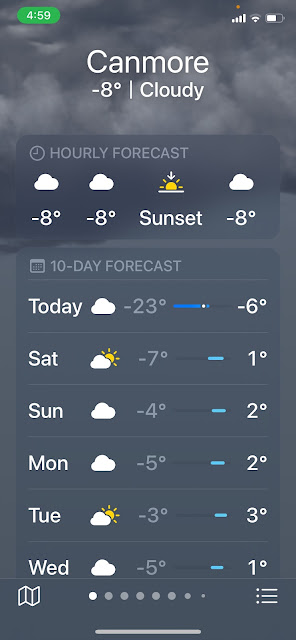
Last Saturday, it was -40°C, today is -6°C and the forecast for tomorrow is in the positives. How does this happen? How does the temperature jump by 20°C in less than 24 hours?
 |
| A chinook causes temperatures to soar! |
This, my friends, is the effect of a chinook.
Our boat is called Chinook and when we describe it as a warm, dry, welcome wind, not everyone understands. But if you live in southern Alberta under the influence of chinooks, these winds are very welcome. When a chinook blows in, the temperatures can jump by 20-30°C in just a few hours. Chinook winds are often called snow eaters.
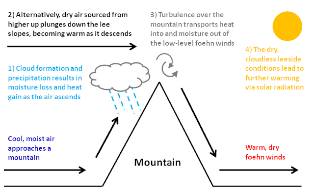
A chinook is a föhn wind, or a warm, down-slope wind on the eastern (or lee) side of the Rocky Mountains. They form due to the tall mountain ranges and the moist coastal air is dropped on the windward side and the high level dry air plunges down the lee side of the mountains. The air warms as it descends and is further warmed by the sun on the clear leeside.
A chinook arch will form under these conditions. This is a very distinct band of cloud with clear skies on one side. A chinook arch occurs when the warm air starts to rise on the lee side of the mountains. Driving between Calgary and Canmore during a chinook, the band of cloud is obvious. We love seeing a chinook arch as it means our time in the deep freeze is nearing an end!
 |
| A chinook arch as seen by Kate and Sean driving west from Calgary |


Comments
Post a Comment