The Irish Loop - 47° 53' 30" N 52° 56' 21" W
 |
| The Irish Loop |
We took a day off boat preparations and headed out sightseeing. First stop, breakfast at Quidi Vidi, a charming cove just to the north of St John's Harbour.
Fully fuelled, we headed off to drive the famous Irish Loop. The Irish Loop is a 310km circuit of the Avalon Peninsula - an endless ribbon of stunning scenery.
 |
| Quidi Vidi |
The Avalon Peninsula is surprising. The mighty cliffs that mark the western edge of the North Atlantic Ocean are as rugged and wild as you would imagine. The tiny villages or outports that huddle in the warmth of the valleys at the mouth of the rivers are colourful and quaint. Most of them sport a wharf for fishing boats. There is no yachting infrastructure, sailing boats are not the normal marine traffic.
We clamoured on the rocks and watched whales at the Ferryland Lighthouse. We enjoyed stunning weather which the locals say is short-lived in this part of the world. Thank goodness we popped a pair of shorts in our luggage when we were packing onboard Chinook a week ago!
 |
| Ferryland Lighthouse |
As we lopped south, the landscape reminded us of The Dempster Highway. It looked like tundra; treeless, small scraggly bushes and mist. After some research, we learned that this is the South Avalon-Burin oceanic barrens which is a taiga ecoregion. This is unique in North America and is more closely associated with the climates in Scotland and Iceland. It is boggy with moss, lichens, flowers and heath.
 |
| How beautiful will this look in the autumn? |
The barrens are popular for partridge hunting and we passed tiny hunting huts scattered on the treeless bogs. The mist rolled in then cleared as we worked our way south.
 |
| Blanket bogs |
 |
| The fence snapped and tossed aside by the waves |
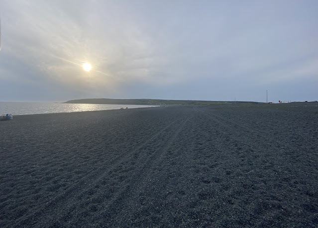
The highlight of the day was St. Vincent Beach. A cobble stone beach of several kilometres along a spit dividing the ocean from the pond (most lakes in Newfoundland are called ponds). It turns out that this beach is a spawning place for capelin. These little fish happen to be a favourite of humpback whales who feed within metres of the beach. We happened across a dozen or so humpbacks enjoying their evening meal, splashing and breaching right off the lapping shoreline. Who needs a boat?
 |
| St Vincents Beach |
We had a great day off, and now it's back to victualling, refuelling and preparing the boat!


Comments
Post a Comment