Fort Ross - 72° 00' 38" N 94° 13' 45"W
 |
| The iconic Hudson Bay Company hut |
In this desolate and remote corner of the world, The Hudson Bay Company set up a trading post to take advantage of the fur trade in the area. So inhospitable and inaccessible it turned out to be, the post was abandoned six years later after supply ships were unable to access the fort for two years. The Canadian government enlisted the help of the US air force to evacuate the personnel. A chap parachuted down to prepare the landing site and it was the first parachute jump north of the Arctic Circle!
 |
| Quite the remote corner |
The abandoned Fort Ross buildings are now iconic images on the NWP transit. A couple of the buildings are now gone, the house is derelict and the old store has been maintained as an emergency shelter. It is boarded up to be bear proof but once inside, it is a cosy oasis with a stove, bunks, cooking utensils and food. Five yachts in the bay and a hut calls for a party! So ashore we all trundled with munchies and drinks and assembled at the hut. It was a huge amount of fun. We even had a visit from the crew of the Canadian Coast Guard ship, the Jean Goodwill.
 |
| The mandatory photo in front of the hut! |
We kept our radios on and dinghies were buzzing between boats for coffees, to help with repairs, pancake breakfasts and chats. There was great excitement when the radio crackled with the announcement of a polar bear on the beach! And there he was, wandered about the hut where we had been the day before and ambling along the shore, past the anchorage and disappeared over the hill. Watching this magnificent creature go about his business from the safety of the boat was such an experience!
 |
| Party time at Fort Ross |
Fort Ross, or more precisely, Depot Bay is a convenient anchorage to wait for the right conditions to transit the infamous Bellot Strait. This is a narrow 16nm strait between the mainland and Somerset Island. It has strong tidal currents, can act like a wind tunnel and is notorious for ice. It can go from ice-free to fully blocked in a matter of hours. At the east end of the strait sits Magpie Rock. The channel runs between this and a wide, shallow section. Deep and narrow, it is particularly prone to tidal eddies and ice build-up. It is recommended to transit this section on a slack tide, two hours before high water at Fort Ross.
 |
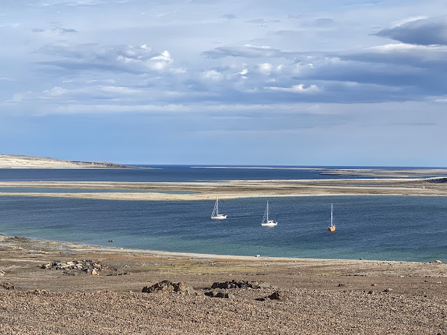
| Inatiz, Hauru and Voyager in Depot Bay |
There was a great deal of discussion and pouring over ice charts and weather forecasts to determine the best time to go. And to make it all a little more interesting, Bellot Strait has a semidiurnal tide. This means there are two tides per day but one is bigger than the other, depending on the time of the month. There is a lot to consider. Night Owl was the first to leave on the Saturday day tide and safely made it through. Inatiz, Lumina and Hauru all left on the Monday day tide. We opted not to go with them as there was some heavy weather in Franklin Strait on the other side of Bellot Strait and planned to leave the day later to avoid this.
We were not alone in Depot Bay for long. Myhann, a French-flagged boat, sailed in not long after they had left. And conditions changed quickly. There had been some ice in the bay and we had had to re-anchor several times to avoid it but suddenly, the bay was full of ice. In the interests of a good night’s sleep, we decided to motor to another anchorage on the Boothia Peninsula, about 5nm away. There, we hoped, we would find less ice.
We discover yet another amazing anchorage with a large flock of snow geese grazing on the shore. With the two boats bobbing happily on the deep calm of Levesque Harbour, we had a solid sleep before our attempt at Bellot Strait next morning.
And check out Marisa and Adriano's video @our_tern on Instagram:

Fascinating…
ReplyDelete